31 December

I was not to know that 11 December would be our last moor walk of the year.  The following weekend was busy with work as we prepared for visitors.  Then the days we could have walked at Christmas were wet and uninviting.  I looked at the forecast and said - Thursday looks good, it would be a good end to the year to have one last trek on Dartmoor.

And until yesterday evening that was the plan.  Moving, with Devon, into tier 3, however, made us feel that travelling to walk was not appropriate, so instead I've got my blog up to date and we'll walk locally.  I'm glad I took a few minutes on Bonehill Rocks earlier this month to reflect, and I was blessed by that hint of a rainbow.

The year started with the aim of visiting 50 tors - the final total is 154!  A revised aim of 50 walks was met with 42 - and all things considered for the year, I'm impressed with my persistence.  I also reached the summit of 47 out of 53 tors of 500m plus.  Grateful to Jonathan for committing with me this year - he's been with me for probably 150 of the walks, patiently snapping shots for this blog.  And grateful to those who've supported my three charities.  I don't know the exact amount collected, but it's over my target of £500 overall.

Hard to choose a favourite photo, but this one maybe reflects how Dartmoor often feels - like it puts things into perspective!


11 December

I picked up a particular postcard (no.284 here) earlier this year and wanted to finish visiting the tors shown.  We climbed Down Tor, above Burrator Reservoir, earlier in the autumn, and last weekend I sought out Combestone Tor.  Today was the turn of Hound Tor (414m) [K17], my 150th tor, which we put together with Greator Rocks (371m) and Holwell Rocks (382m).  By this time the weather had turned a little, and we were glad of our waterproofs.  

Hound Tor:


Greator Rocks:

Holwell Rocks:


To find the fourth postcard tor, we drove on toward Widecombe, and parked at Bonehill Rocks (393m).  When we visited Bell, Chinkwell and Honeybag on our second walk of this year, the pull up from Widecombe was too much for me to face adding in these rocks, so this was a return visit.  I'd kept my wellies on from the Hound Tor walk, so left Jonathan in the car and wandered around the rocks on my own for a short while.  There are some lovely views to the south - on this occasion with some bits highlighted by the sun - and as I came around and was looking north, there was the beginning of a rainbow.  It was a good time to reflect on my visits to the moor this year, to be thankful for all we have achieved, come rain or shine!


6 December

 At long last, I persuaded my youngest daughter to come to the moor with me.  We took pasties from Bakers and visited Combestone Tor (356m), an impressive set of rocks near the roadside. Back across the moor with the late afternoon sun in our eyes - not the safest driving conditions.


Quick phone stitched panorama from the tor:


28 November

 A foggy walk, from Cold East Cross, southwards to Buckland Beacon (383m) [N17], from where the views were non-existent! 

We were able to find the two 'Ten Commandments' stones, though.  To the standard 10 are added Jesus' new commandment from John 13v34, and these insightful verses, one on each of the stones:

Before the hills in order stood
or earth received her frame
from everlasting thou art God
to endless years the same.
 
But there's a power, which man can wield
when mortal aid is vain
that eye, that arm, that love to reach,
that listening ear to gain.
That power is prayer. 

Onward in search of Welstor Rock, but we couldn't find a path there through the gorse/fog.   The one thing we did see on the initial bit of path from the car park was loads of dog poo - which we haven't experienced anywhere else on the moor.  We found a different way back to the car!

21 November

A quest to find a rock we've driven past so many times - Roborough Rock (200m) [R4].  A brief wander southwards as the airfield to the north was busy with people, but on finding ourselves at the golf course, we didn't get far.


13 November

Walking just east of Tavistock, we went in search of a number of tors: Prowtytown Rocks (300m) - worth it for the views westward! Pew Tor (322m), on to Sampford Tor, (293m), back via Hucken Tor (313m), Heckwood Tor with a view of the unreachable Vixen Tor (321m) [N5], Feather Tor (313m) and Barn Hill Rocks (336m).  All pictured below:


On the way back to the car we passed Windy Post [N4].  The 'bull's eye' in the leat stone was not visible though, as the water was too high and completely flowing over the rock. On our return, I read Jonathan the poetic version of the legend of Vixen Tor from the Dartmoor 365 [N5] book.  It's a lovely mix of Hiawatha and Dartmoor imagery.


6 November

In view of the new lockdown, we decided to walk closer to home during November, shorter walks without extra stops.

Today's was from Shaugh Bridge [T4] to Cadover Bridge - south side first, with views of Dewerstone Rock [T5], then back along the north side, past the restored cross, Cadworthy Tor, (238m) and over the top of Dewerstone Rock (227m).

It was a lovely autumn walk, often in sunshine.

View of Dewerstone from the south of the valley.

Beginning the walk back north of the valley.


Restored cross.


Engraved names on top of Dewerstone.


Back through the woods.


25th October

A different walk today as we had just a short time window between rain showers and things going on at home.  We parked near Lee Moor, just beyond Whitehill Tor, where there's a P on the OS map.  There are three tors within the bounds of the China Clay works - not technically part of the moor, but still listed in Ken Ringwood's book.

We found two - Blackalder Tor (234m), which sits on the side of a ridge forming part of the edge of a clay pit.  Then close to the car on the way back was Whitehill Tor (210m).  

Both give views of the china clay works, and also the tungsten mine.  Most of what can be seen here is solar panels, but there are plans to reopen to mine for tungsten in 2021.  It made a different kind of walk, but good to get some fresh air in between the showers October has provided!

I'm really grateful to the churches of Saltash Methodist Circuit for their generosity towards my three charities this year - especially Christians Against Poverty.  I've hit my targets (once offline donations are included) for them and the Mbare-Saltash Partnership.  Just two more months to go, so it will be Shekinah in the spotlight from herein!

17th October

October is proving to be wet, but we managed a dry walk, sunny in parts.  Starting from Sourton Village Hall, we set off towards Sourton Tors, but branched off to make our way around them first, climbing steadily.  For a while we followed the Rattlebrook Railway [E5], joining at the reversing point, which you will see if you check out the link.

The first time we branched off to find our first tor, we did so on the wrong side of the Lyd, which was impossible to cross!  Coming back to the track, we then found the right path, which although still soggy, led us on to Gren Tor (516m).  

On the way there were lovely views of the Lake Viaduct [E4], which we cycled across some years ago.  Continuing on up Woodcock Hill, we found Hunt Tor (562m), from where we could see our next two destinations.

At some point here, wellies became a necessity again.  With no soil to drain into, the water simply sits on these high levels of the moor, often in the pathways, as these are slightly more worn down than the surrounding grassy tummocks.  We made our way to Kitty Tor 579m, which is on the edge of one of the firing ranges and has an army hut and flag pole.  The views are impressive too - we were looking towards High Willhays and the other top peaks once again.

Our next tor, Steng-a-tor (541m), was the most soggy.  I did think it looked a bit like a dinosaur, as the name might suggest!  

Then coming along Corn Ridge with varying pace as we tried to keep to a path, but kept finding we had to detour to avoid sinking too deep.  There are views here of Links Tor, which although not quite over 500m, will be one we try to visit at some point.  It sits on its own with deep valleys either side, so is not easily combined with other tors in a walk.  Eventually we made it to Branscombe's Loaf (538m), taking four more off the list of tors over 500m.

We did investigate Sourton Tors (440m) on the way back, although the hunt for East Tor (405m) meant we went down and up again - not ideal having walked 6.5 miles already.  Overall it was just over 8 miles, a little less than expected, as our template was this walk from treksandtors.

9th October

Last weekend was too wet and too work filled for walking, so today we were glad that at least the morning looked dry.  Aware that the sun might not hang around for long, another short walk was planned.  We drove via Ashburton to one of the car parks beneath Saddle Tor.

Saddle Tor (428m) does look like a saddle, and it's an easy walk to the summit, if wet underfoot at the moment.  From there we headed to Fitches Holt (413m), which is part of Emsworthy Rocks (399m).  The latter are famous for photos of one particular tree, but the tor itself stretches over a wide area.  Jonathan's website doesn't include one at the moment, so the link is from one of his photographer friends, Neil Porter.  For the benefit of keeping going on our walks, Jonathan sticks to the camera on his phone!

Just down the hill from there is also Little Emsworthy (357m), from where we made our way through the brown bracken to Little Holwell (389m).


You will see from this photo of part of  Holwell Tor (402m) that we should have known what was coming later!


Our last tor was the iconic Haytor Rocks (457m).  Two outcrops, one of which when approached from Saddle, Emsworthy or Holwell looks as though you would need to be a climber to climb it.  I did discover though, that from the other side, there are steps made in the rocks, so although I didn't quite make the very top, that's me waving in the middle!


We then sheltered from the wind beside the other outcrop to have a hot drink.  Unfortunately, in the time it took for me to climb and for us to have a drink, the weather drew in.  As we began to retrace our steps towards Saddle Tor and the car beyond, the rain began.  And it was proper rain.  And we'd left our waterproof trousers in the car.  Suffice to say, we became soggy very quickly!


27 September

As last week's walk was a bit mammoth, and weather/work put our walking day back to Sunday, a shorter walk was in order, and not too far away.  We drove onto the moor from Yelverton, and headed to the end of Burrator Reservoir.  I'd found a group of tors to the east of the water to hunt for.

At first, though, the hunting did not go well.  We set off into the Narrator Nature Reserve, in search of the Rough Tor at Burrator.  Unfortunately, we didn't make it into the right plantation, and ended up crossing Middleworth Plantation instead to a different track. Having lost time, Click Tor was also abandoned for another day.

Coming out of the trees, the next tor was in sight - Cuckoo Rock (328m) [Q7] - which is a massive granite boulder.  It sits on the side of Combshead Tor (371m), where we climbed next.  It was a clear afternoon, and the views were terrific, even able to see the sea.


Here's the stone row close to Combshead Tor, stretching from the circle into the far distance.  It's Down Tor Row [Q8].


Combshead was our highest point, but from there we walked downwards towards the lake, with more beautiful views.  Hingston Hill (367m), Down Tor (366m), Little Down Tor (312m), Snappers Tor (285m) and Middleworth Tor (290m) were all on the way.


18th September

It was supposed to be a short walk week, but having had another week with no rain, it made sense to head to the high moor again.  Having missed Beardown due to firing last week, we headed to Two Bridges for one of our longer treks!

Just back across the bridge from the car parking area, there's a footpath over a stile.  It leads through a very pretty area, walking up by the Cowsic River through a small woodland.  The path then crosses the river, and is well signposted through a farm.  A little way up, it turns off along a leat, climbing gradually and passing through a corner of the forested area.  A way on out of the forest, we crossed the leat over a stone bridge and began a climb up to our first tor.  We clambered up two of the three Beardown Tors (513m), one with the flagpole, and also the highest point.  Tor number 1.


There was a clear path on to our next summit - Lydford Tor (510m).


From Lydford, we headed north west, still on a fairly clear path, at least until we reached the Cowsic again. Here the Cowsic meets Conies Down Water at Travellers' Ford [K8].  It's another crossing way of the Lych Way.  The other side of the stream was quite boggy, and then a steep climb to Conies Down Tor (533m), number 3.


The direct route to our next destination would have been down and up, but instead we found a path, albeit boggy in places, on a fairly level plain around to Beardown Man [J8].  It was a bit blowy - here is my sherpa, with his big rucksack carrying wellies again just in case, making sure the Man didn't fall in the wind!  It's worth having a read about this menhir - it's the one at the highest altitude on the moor.  I challenged Jonathan to write him a new poem - I'll let you know if he follows up on the commission!


Tor number 4 is right next to the menhir - Devil's Tor (549m), our highest point of the day.


The path onwards was vague in parts, and boggy, but still not quite bad enough to need wellies.  I was very glad this was after a couple of dry weeks.  Here is Rough Tor (547m), number 5.


From Rough Tor, we headed downwards to the iconic Crow Tor (501m) [K9] and Little Crow Tor (500m).  It's very recognisable and yes, named for looking like a crow's beak.  6 and 7.


From Little Crow, I wanted to fill in a gap from a previous walk.  When we visited Higher White Tor earlier last month, I didn't realise there was another tor over 500m just on the side of Higher White.  So we headed down to the West Dart River, which is a large stream here, crossable on rocks, and up to Little Whiten Tor (501m).  It's much more obvious approaching from this side, for sure.  A total of 8 new tors over 500m completed.


Rather than heading along the valley, we found a stile across the nearby wall, and headed towards Longaford Tor.  In retrospect, it might have been easier to continue to Higher White, from where there is a clear path to Longaford.  Instead it was mostly through high grass and tummocks, so not the easiest part of the day.  We visited Longaford and Littaford earlier this year, but this time I will add in Little Bee Tor (450m), which is the last tor we saw before descending to the track towards the car.  A 10 mile walk, and we were very ready to stop at the end!


11 September

 We've had the idea of walking one longer trek one week, then shorter the next, so this was a week for a longer trek.  Beardown was one option, but there was firing in the Merrivale range, so instead we drove out to Fernworthy Reservoir.  We parked as far into Fernworthy Forest [G12] as possible, which is at the south westerly end of the reservoir.  We'll have to come back some time to walk around the water, which I think is possible.

Instead, we were heading up! Jonathan had read that part of our planned route could be wet underfoot, so he carried wellies in the rucksack as well as our snacks. At least there hadn't been any major rain for about a week, so we hoped the marshy area would at least be passable.

We did manage to miss one path in the forest - we discovered why later - and that meant we went further down than planned, emerging from the forest by a stream.  We followed the outer wall back up the hill, as we knew there was a wall leading to our first tor.  From there the path was quite clear - and we followed the natural detour to Grey Wethers stone circles [H11].  These circles were restored in 1909, with fallen stones returned to their holes, so they stand as they would have done 4000 years ago.  

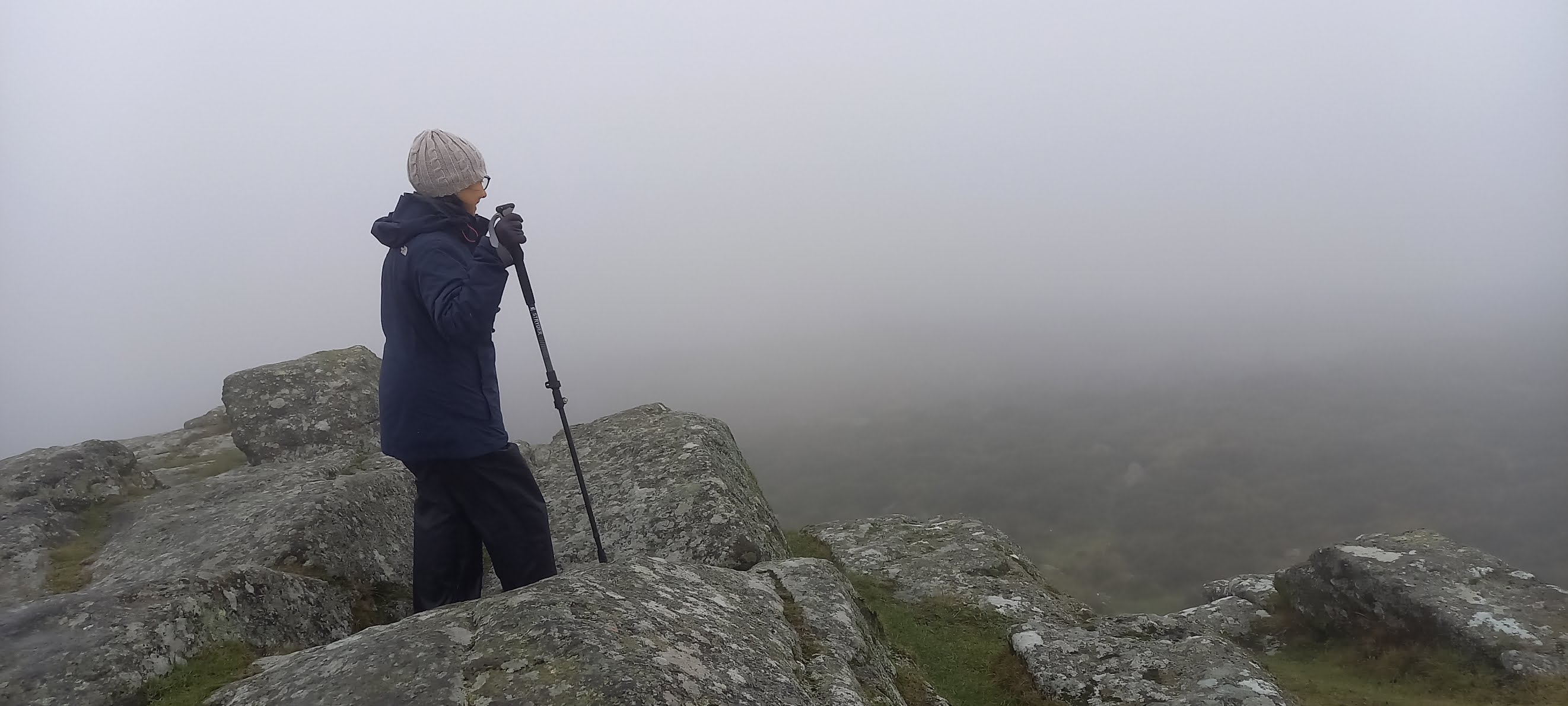
The path led on to our highest point of the day, Sittaford Tor (538m).  

From Sittaford, I wanted to head onto Kit Rocks, but there was no clear path directly there.  Instead, we took the path which is clear on the satellite maps to Statt's House [H10].  A short way along here, we did decide to change into wellies, which made the going somewhat easier.  When you're not worried about water up to your ankle, it's easier to stride on!  The house there has no roof, but the fireplace is still clear.  It was a shelter for peat cutters, and there certainly is plenty of peat in the area.  

Finding Kit Rocks was somewhat more difficult, as you'll  see from the view of our walk.  It was a case of following sheep trails until we realised we were heading in the wrong direction! Again, very glad of wellies, as there was a boggy stream to cross at one point.  Kit Rocks (520m) are not terribly impressive, but sit at the side of the East Dart, which is a little prettier!

On the way back we did avoid the boggiest part, but it was often through long grass, until we reached the Statt's House path again. On the way back through the forest, we found why we'd missed the path earlier.  Marked as a track on the OS map, I think you'd have needed a major piece of machinery to drive on it!  It was a really pretty way down through the Forest though, and we'd have missed it even from the top without GPS.  

At the bottom looking up, it just looked like a grassy verge, so the way through was well hidden and it was no surprise we'd missed it.

A little further back, we stopped by the Fernworthy Circle.  It was freshly mown, and we had a chat with the gentleman who'd just completed the work.  The Forestry Commission have the grass around these antiquities and others in their managed forests on the moor cleared once a year - so now is a good time to visit.  He'd done an excellent job.  

By the time we were back at the car, we'd walked 7.8 miles, so quite a long way for two tors!